
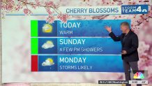
4 things to know about the weather:
- Summer-like warmth today.
- A few PM Sunday Showers.
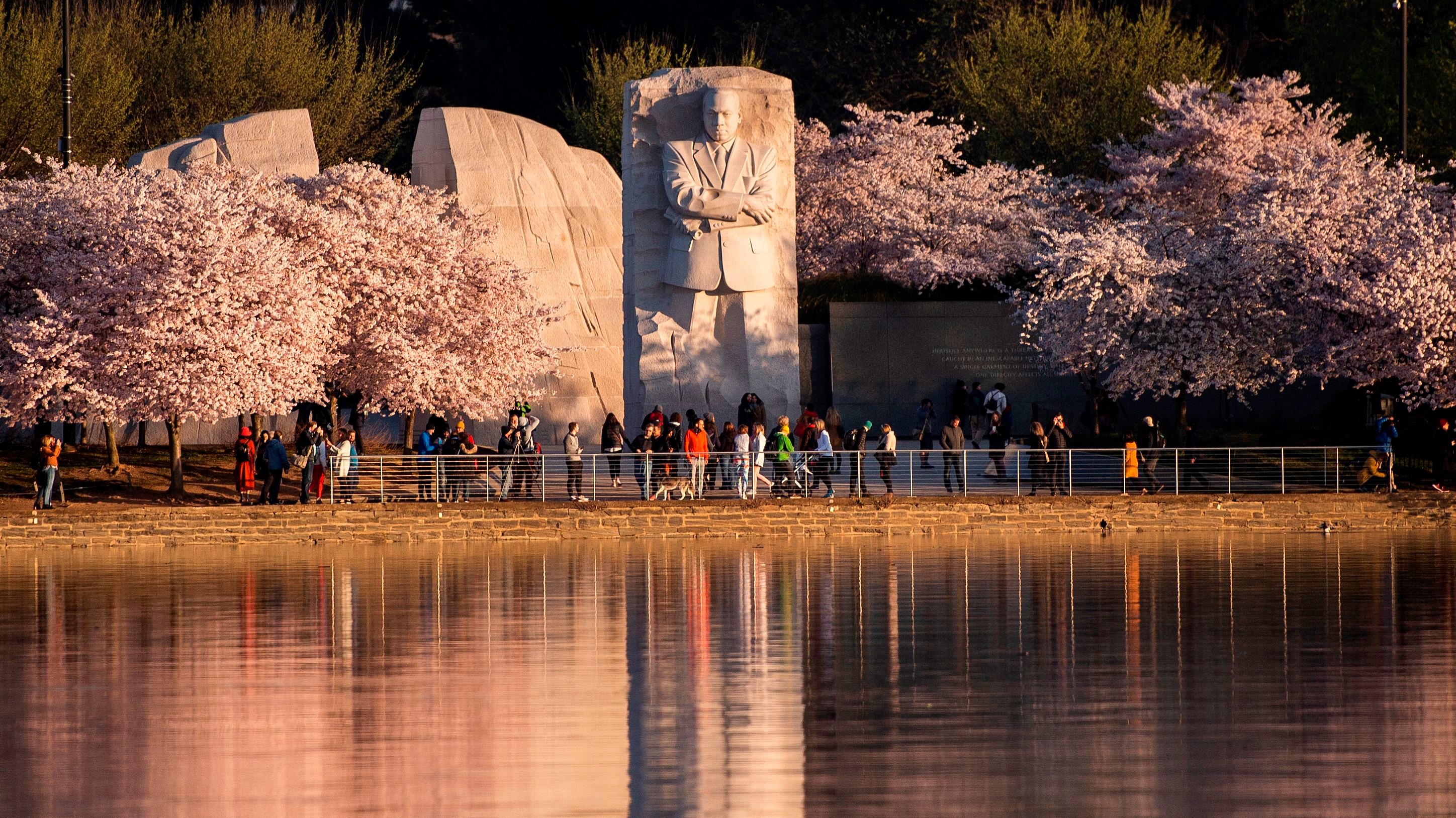
- If the cherry blossoms are your thing, get it in this weekend.
- Showers & storms likely Monday.
A surge of warm air came our way Friday afternoon and will push temperatures about 20° above average for the upcoming weekend.
Southwest winds overnight held temperatures in the mid- to upper 50s. That mild start on Saturday will be just the beginning of weather more typical for Memorial Day than late March.
We've got the news you need to know to start your day. Sign up for the First & 4Most morning newsletter — delivered to your inbox daily. Sign up here.
Clouds will give way to increasing sunshine Saturday afternoon. Most of the area will reach at least 80° with a few mid-80s in metro D.C.

Clouds will thicken Saturday night, keeping many areas above 60°. Sunday will come with plenty of clouds and a strengthening southwest wind. Most of the day will remain dry but rain chances will begin to increase by late in the afternoon.
Highs on Sunday will once again get close to 80°.
Hit and miss showers Sunday evening will turn into a likelihood of rain by Monday afternoon with highs remaining in the 70s.
Tuesday and Wednesday will be much cooler and drier, with highs staying in the 50s.
Weather radar
Download the NBC Washington app on iOS and Android to check the weather radar on the go.
10-day forecast
Quickcast
TODAY:
Mostly Cloudy
Very Warm
HIGHS: Lower to Middle 80s
TONIGHT:
Cloudy
Isolated Showers
Temps: 50s Suburbs to Middle 60s Downtown
SUNDAY:
Cloudy
Scattered PM Showers
HIGHS: Upper 70s
MONDAY:
Showers and Thunderstorms
HIGHS: Middle 70s
TUESDAY:
Partly Sunny
Much Colder
HIGHS: Upper 50s
Sunrise 6:57 Sunset 7:29
Average High: 61° Average Low: 42°