
4 things to know about the weather:
- Goodbye, sunshine
- Near-average Wednesday
- 80s return Thursday
- Weekend showers likely
A major storm in the upper Midwest will generate a large severe weather outbreak Wednesday over the Mississippi Valley. The Storm Prediction Center has issued an extremely rare HIGH RISK (Level 5 out of 5) that is centered around Memphis, Tennessee. If you have friends and family in southern Indiana or Illinois, western Kentucky or Tennessee, eastern Arkansas or northern Mississippi, give them a friendly call or text to alert them about this dangerous weather threat.
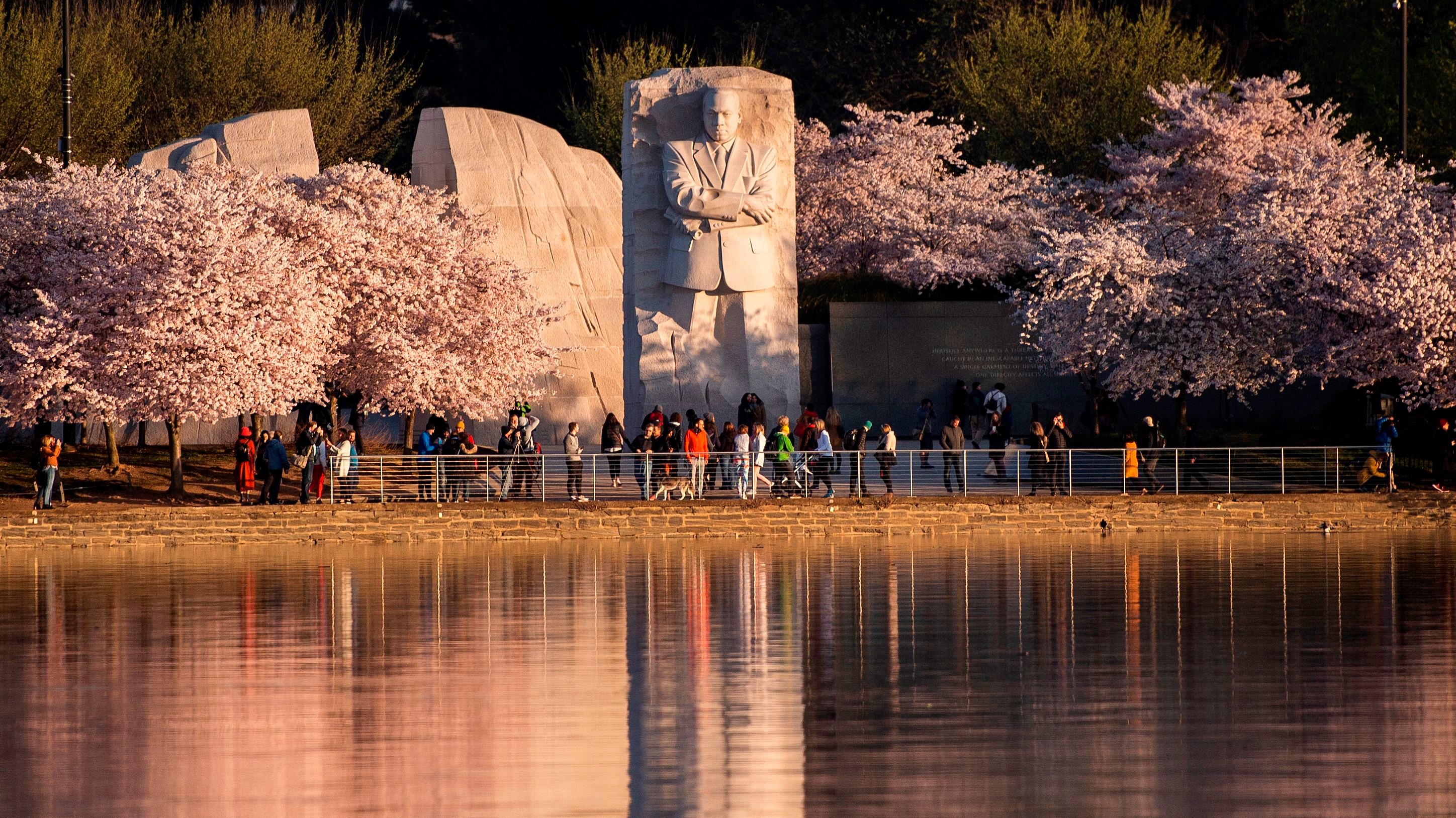
Our weather here in the D.C. area will be relatively quiet. Clouds will increase, as will the southeast wind, during the day. High temperatures will be just below average (63°), and there will be a small chance for a sprinkle of rain Wednesday evening.
We've got the news you need to know to start your day. Sign up for the First & 4Most morning newsletter — delivered to your inbox daily. Sign up here.
The storm to our west will send a warm front our way Wednesday night. Temperatures may drop a few degrees after sunset but should start rising again after midnight.
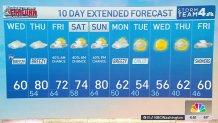
Most of the D.C. metro area will start out above 60° Thursday morning. Strong southwest winds will bring clouds, warm air and a few showers into the area for Thursday, with highs likely getting above 80° again. That will be our fourth 80° in the last six days!

Rain and warm weather through weekend
Our best chances for rain, and even a few thunderstorms, will come Thursday night into Friday morning.
Friday afternoon and Saturday will both remain very cloudy with a weather front stalled out over the region. Just south of the front, Richmond will stay around 80,° while most of our area will be stuck in the 60s to around 70°. Any variation on where that front is located will lead to a big change in our temperature forecast.
As the next storm crosses the Great Lakes, the warm air will return. Most of the DMV will be above 80° yet again on Sunday afternoon, with a chance of rain late in the day and evening.
A cold front on Monday will bring the chill back next Tuesday and Wednesday when highs will stay in the 50s.
Weather radar
Download the NBC Washington app on iOS and Android to check the weather radar on the go.
10-day forecast
Quickcast
WEDNESDAY:
Increasing Clouds
Cool, Breezy Afternoon
Few Evening Sprinkles Possible
Chance Of Rain: 10%
Wind: Southeast 12-24 mph
HIGHS: 56° - 62°
WEDNESDAY NIGHT:
Mostly Cloudy
Light Rain, Drizzle
Steady Temperatures
Wind: South 5-10mph
Chance Of Rain: 20%
LOWS: 52° - 58°
THURSDAY:
Mostly Cloudy, Breezy
Much Warmer
Widely Scattered Showers
Wind: Southwest 14-28 mph
Chance Of Rain: 25%
HIGHS: 76° - 82°
FRIDAY:
Mostly Cloudy
Cooler But Still Mild
Occasional Showers
Wind: North 5-10 mph
Chance Of Rain: 60%
HIGHS: 68° - 74°
SATURDAY:
Mostly Cloudy
Few AM Showers
Mainly Dry Afternoon
Wind: Southeast 5-10 mph
Chance Of Rain: 40%
HIGHS: 66° - 72°
Sunrise 6:51 a.m. // Sunset 7:33 p.m.
Average High: 63° // Average Low: 44°