


4 things to know about the weather:
- Weather Alert: Storms from 3 p.m. to 9 p.m.
- Much colder Tuesday, Wednesday
- Warm again on Thursday
- Potentially rainy weekend
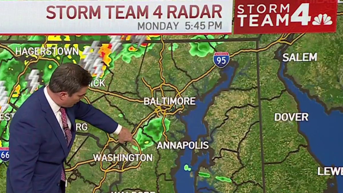
Monday is a Storm Team4 Weather Alert Day with a risk of strong to severe storms from 3 p.m. and 4 p.m. Monday afternoon until 9 p.m. and 10 p.m. in the evening.
Our area is under a slight risk for severe weather (threat level two out of five), according to the Storm Prediction Center in Norman, Oklahoma. The primary severe weather threat will be damaging straight-line winds associated with the strongest cells.
We've got the news you need to know to start your day. Sign up for the First & 4Most morning newsletter — delivered to your inbox daily. Sign up here.
Frequent lightning and hail up to 3/4 inches will also be possible. A burst of rain, which we desperately need, will also come with these storms. On average, half an inch to 3/4 inches appears likely, but, as is often the case with thunderstorms, much higher amounts will be possible.
Localized amounts of an inch to 2 inches will be possible along the east and south of the I-95 corridor into Southern Maryland. The rainfall rates may be intense enough to overpower drainage capacity leading to flash flooding in urban and flood-prone areas between 5 p.m. and 8 p.m. After Monday, our next best chances for rain won't arrive until Friday and the weekend.
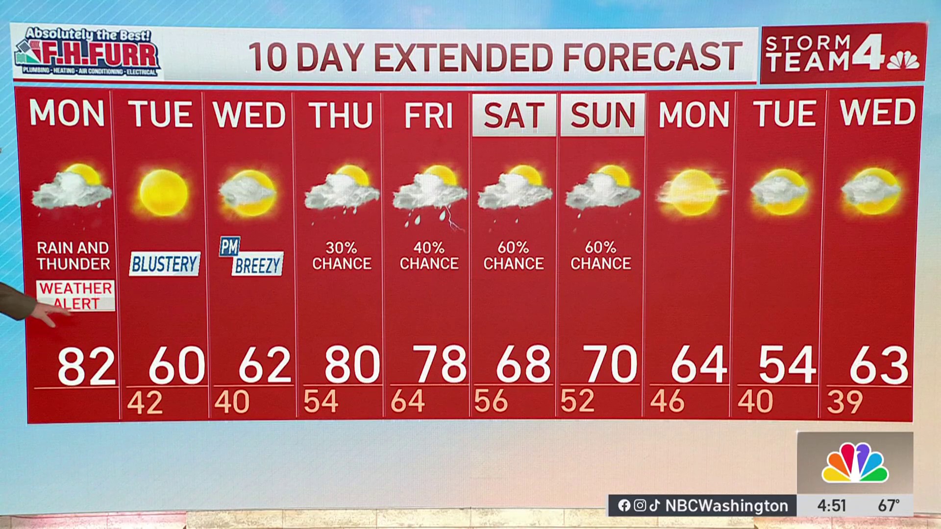
Daytime temperatures will also be on quite a journey this week. Monday may well be our third 80° day in a row, following Saturday's 86° and Sunday's 83°. How far above 80° we get will depend on exactly when the storms and cold front arrive.


Expect up and down temperatures this week
The cold front should reach Metro D.C. around 8 p.m. Temperatures will drop 15-20° within the first hour or two after the rain begins. By Tuesday morning, gusty northwest winds will have driven temperatures into the 30s and low 40s.
Prepare for wind chills to be near or below freezing Tuesday morning after enjoying highs above 80° Monday afternoon! Tuesday afternoon will be sunny, breezy and chilly with highs only around 60°.
Clouds will return on Wednesday keeping highs near 60° once again. Southerly winds Wednesday night will allow for rising temperatures after midnight.
Thursday morning temps will start in the low to mid-60s and most of the area will be near 80° Thursday afternoon. As the warmer air returns, there will be a small chance for a sprinkle of rain Wednesday night and throughout the day Thursday.
Friday and the weekend look unsettled with rain chances each day and some more wild swings in temperatures likely.
Weather radar
Download the NBC Washington app on iOS and Android to check the weather radar on the go.
10-day forecast

Quickcast
MONDAY:
Breezy And Very Warm
PM Rain, Thunderstorms Likely
Severe Storms Possible 3-9PM
Wind: Southwest 14-28 mph
Chance Of Rain: 90%
HIGHS: 78° - 84°
MONDAY NIGHT:
Evening Storms
Dry After Midnight
Blustery, Turning Colder
Wind: Northwest 12-24 mph
Chance Of Rain: 60%
LOWS: 34° - 42°
TUESDAY:
Sunny Skies
Blustery Through Noon
Chilly
Wind: Northwest 10-25 mph
Chance Of Rain: 0%
HIGHS: 56° - 62°
WEDNESDAY:
Increasing Clouds
Cool, Breezy Afternoon
Isolated PM Shower Possible
Chance Of Rain: <20%
Wind: Southeast 10-25 mph
HIGHS: 58° - 64°
THURSDAY:
Mostly Cloudy, Breezy
Much Warmer
Isolated Showers
Wind: Southwest 14-28 mph
Chance Of Rain: 30%
HIGHS: 76° - 82°
Sunrise 6:54 Sunset 7:31
Average High: 62° Average Low: 43°

