


4 things to know about the weather
- Cloudy days continue
- Light rain, drizzle expected
- Hurricane Helene forming
- Weekend looks wet
The big weather story over the next few days will be the development, track and landfall of what's expected to become Hurricane Helene.
Here at home, we will be stuck in the clouds for most of the foreseeable future. You'd like to think that all these clouds would deliver a drought-busting amount of rain, but they won't.
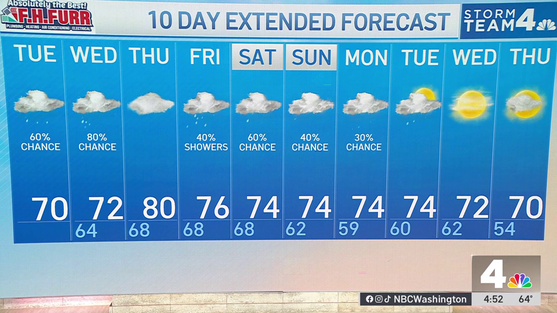
Rain totals Tuesday will be less than 1/4 inch for most of the area. Rain totals should be higher Wednesday with localized amounts over an inch possible south and west of metro D.C.
A coastal flood warning is in effect for D.C. and in parts of Maryland and Virginia. Check our weather alerts to see which counties are affected.
A big push of warm and very humid air will come our way Thursday as Helene makes a run at the Gulf Coast. Dew points here will climb into the 70s so it will feel mid-summer humid on Thursday afternoon. Thursday will remain mostly cloudy and warm, with highs near 80°, but should be dry for most of the day.
Weather radar
Download the NBC Washington app on iOS and Android to check the weather radar on the go.
Storm Helene to hit Florida, likely bring rain to D.C. area
The storm is likely to take on the name Helene later Tuesday, reach hurricane strength by Wednesday evening and make landfall (perhaps as a Category 3 major hurricane) by Thursday night!
The strike point on the coast still looks to be north of Tampa and east of Pensacola in the Big Bend area of Florida. That said, the entire west coast of Florida, especially from Sarasota northward, will experience significant rain, wind and storm surge flooding.
Travel in and out of Florida will be severely impacted. Think twice before making a trip there between Wednesday and Friday.

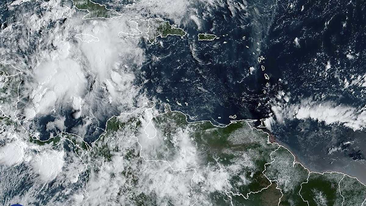


What happens to all of Helene's deep, tropical moisture remains an open question. There's no doubt we will get at least some rain from it, but there is no consensus on how much. Some of our forecast models give us 2 inches while others give us less than an inch.
Southwest Virginia will certainly get quite a bit more rain than the D.C. area. Stay tuned for updates as new information develops.
The weekend will remain quite unsettled with that remnant moisture to our south and west. Rain chances will stay in the forecast from Friday into early next week.
10-day forecast
Quickcast
TODAY:
Cloudy Skies
Sprinkles And Drizzle
Rainfall Less Than 0.10"
Wind: Southeast 5-15 mph
Chance Of Rain: 60%
HIGHS: 65° - 70°
TONIGHT:
Cloudy Skies
Showers Likely
Some Thunder Possible
Chance Of Rain: 60%
Wind: Southeast 5-10 mph
LOWS: 60° - 66°
WEDNESDAY:
Cloudy And Humid
Showers Likely, Some Thunder
Rainfall: 0.50" to 1.0"
Chance Of Rain: 80%
Wind: Southeast 5-10 mph
HIGHS: 70° - 76°
THURSDAY:
Mostly Cloudy
Warmer, Very Humid
Dry For Most
Wind: Southwest 5-10 mph
Chance Of Rain: <20%
HIGHS: 76° - 82°
FRIDAY:
Cloudy And Humid
Rain Likely
Heaviest Rain South Of DC
Wind: East 10-20 mph
Chance Of Rain: 60%
HIGHS: 72° - 78°
Sunrise 6:58 Sunset 7:01
Average High: 78° Average Low: 61°

