- This is the first time in four years that El Niño has been active as winter begins, according to the NOAA.
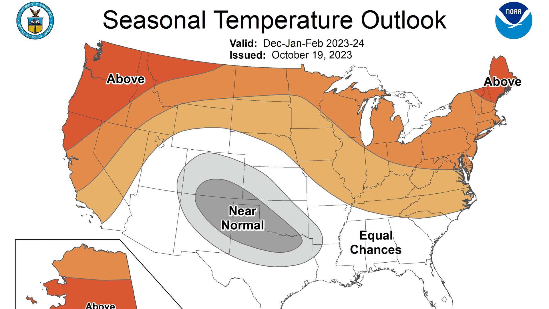
- Temperatures in the northern and far west parts of the U.S. will be warmer than normal, the NOAA forecasts.
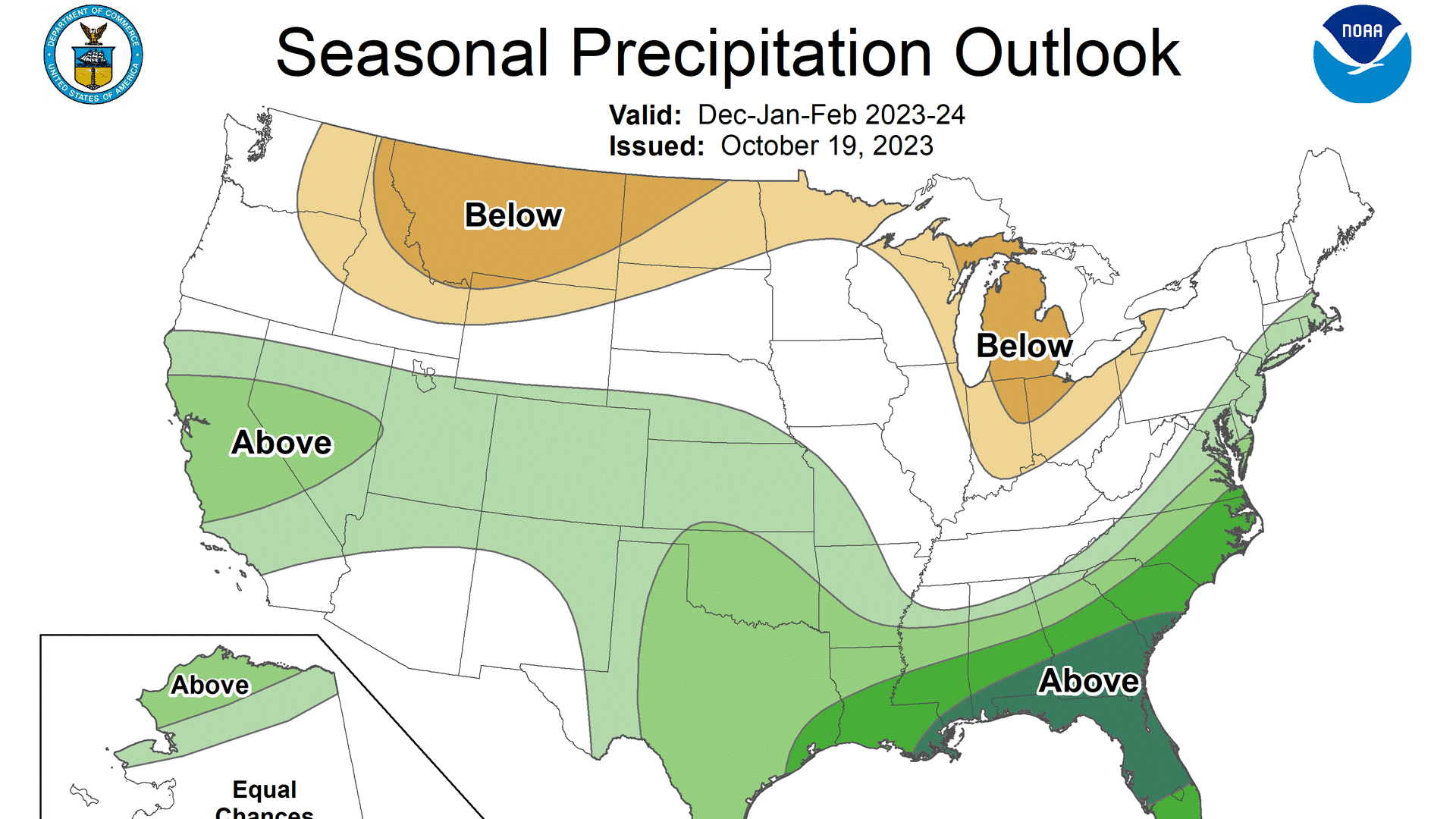
- Portions of northern Alaska, some parts of the West, the Gulf Coast, the southern plains region, the lower mid-Atlantic and southeastern U.S. will be wetter than normal, the NOAA predicts.
The El Niño weather pattern is still active heading into the winter this year and it will mean the northern and far west portions of the U.S. will have a warmer-than-usual winter. Also, some western and southeastern swaths of the U.S. will have a wetter winter than usual, according to a prediction released Thursday from the National Oceanic and Atmospheric Administration.
El Niño, meaning "little boy" in Spanish, and La Niña, meaning "little girl" in Spanish, are opposite weather patterns driven by a change in the trade winds in the Pacific Ocean. When active, they can affect weather conditions around the globe.
This is the first time in four years that El Niño has been active as winter begins, according to the NOAA.
Temperatures in the northern and far west portions of the U.S. will be warmer than normal, especially in Alaska, the Pacific Northwest and northern New England.

El Niño will also mean portions of northern Alaska, some parts of the West, the Gulf Coast, the southern plains region, the lower mid-Atlantic and the southeastern U.S. will likely see a wetter-than-usual winter, according to the NOAA.
Money Report
"An enhanced southern jet stream and associated moisture often present during strong El Niño events supports high odds for above-average precipitation for the Gulf Coast, lower Mississippi Valley and Southeast states this winter," Jon Gottschalck, of the NOAA's Climate Prediction Center, said in a written statement.
Parts of the northern Rockies and central Great Lakes region, specifically Michigan, northern Ohio and Indiana, are forecast to have a drier-than-normal winter.

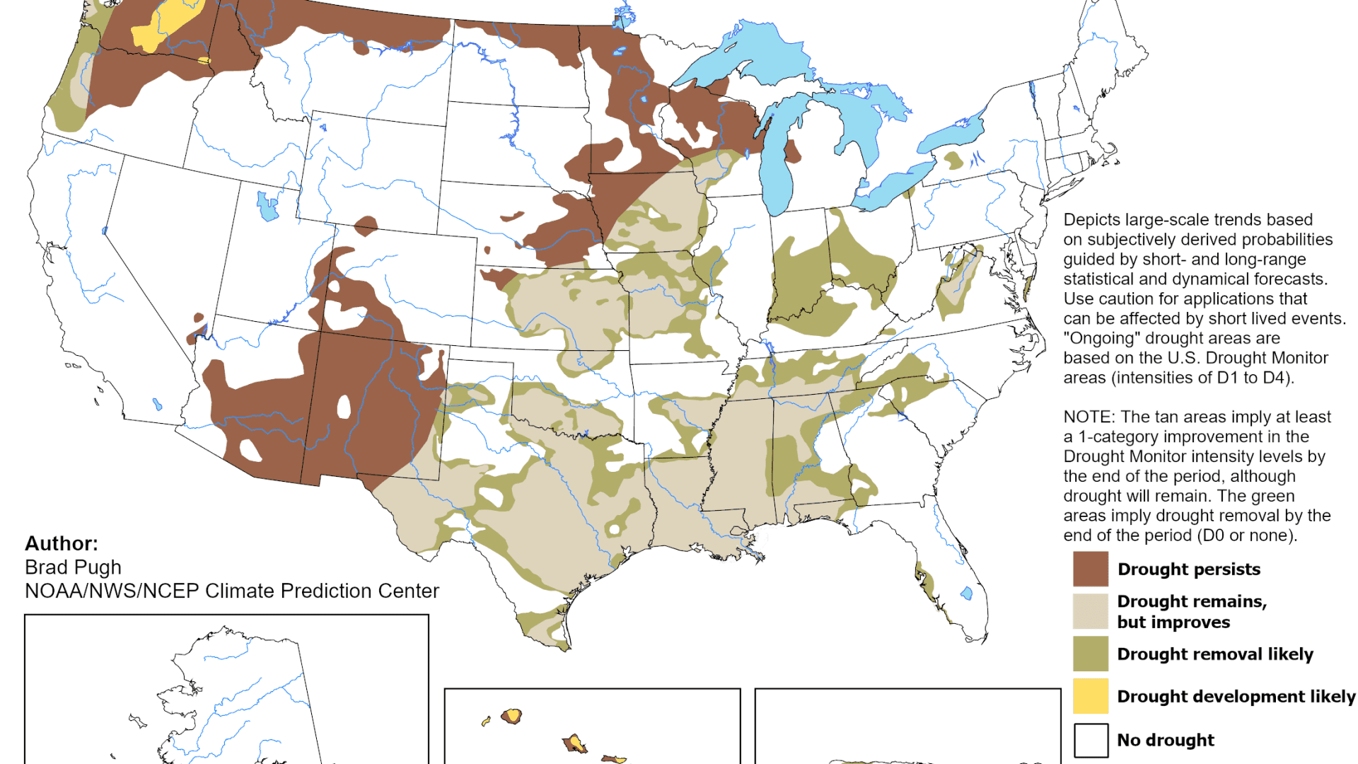
One-third of the U.S. is in a drought as of Oct.17, according to Brad Pugh, operational drought lead with the NOAA's Climate Prediction Center. And so for some regions, the extra rain will be welcome.
"During late October, heavy precipitation is likely to result in drought improvement for the central U.S. El Niño with its enhanced precipitation is expected to provide drought relief to the southern U.S. during the next few months," Pugh said in a statement.
While El Niño rains will alleviate ongoing droughts in some regions, it may also drive the development of drought conditions in the Pacific Northwest. Hawaii's drought, which contributed to the Maui fires earlier this year, is also forecast to persist or worsen.

Don't miss these CNBC PRO stories:
- This bank just hiked its 1-year CD rate to a fresh high
- A low-cost way to protect against an S&P 500 drawdown as risks escalate
- How to invest $1 million for the next decade, according to private bankers and wealth advisors
- This highly profitable industry is booming as the population ages
- Bank of America sees risks for employers as insurance coverage of weight loss drugs grows


